It’s that time.
Time to start planning my first trip to the Adirondacks for the season. I have developed a planning method that has been working well for me so far. My time estimates and weather predictions have been more “on” than “off” on most of my hikes so I’m sticking to my method.
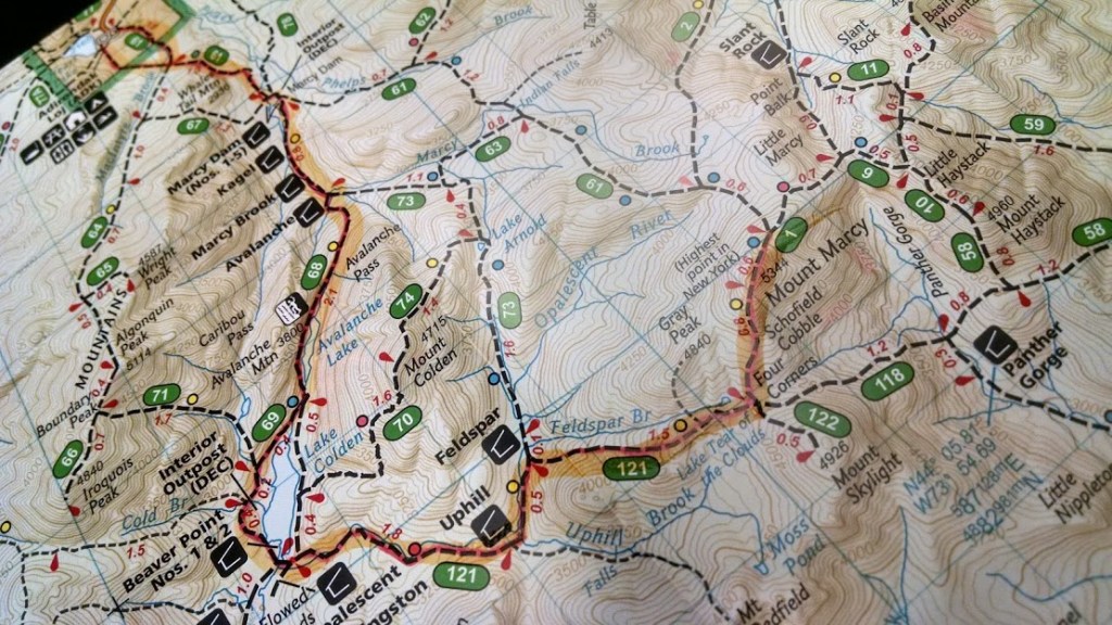
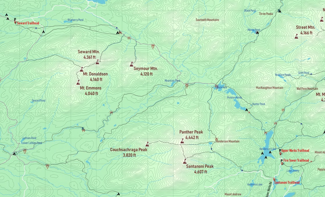
The first thing I do is look at the list of remaining peaks I need for the 46 then break out the map. I am at the point in the 46 where there are only a few “ranges” left. After the Seward’s and the Santanonis I have a hodge podge of summits scattered throughout the Park.
Once I have determined how many days I want to spend on the trip I drill down to a rough plan; something like “Travel early in the AM . Arrive at trailhead. Hike to campsite. Set Camp. Summit a peak or two. Return to camp. Next morning hike all day. Return to Camp. Next morning hike back to trailhead. Travel Home.” If I have more time I may pencil in travelling to another trailhead, maybe resupply along the way, etc.
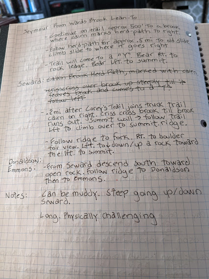
I then consult the Adirondack Atlas to get an idea of trail elevations/slope.
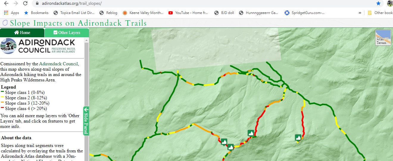
I don’t use any complicated equations for hike time, just the “rule of thumb” of 3 MPH on the flats (green/yellow), 2 MPH on “rugged terrain” (yellow/orange), and 1 MPH on the steepest (orange/red). Depending on what “color” dominates a particular leg of the hike, I just plug in the time estimate…I always err on the side of slower if it’s an area I have never been to before. If I’m familiar with the area I can make a more accurate estimate based on previous hikes.
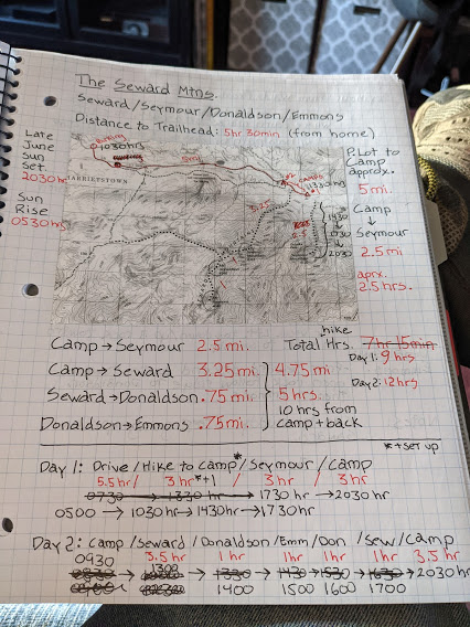
Now I break out my notebook and start marking out legs of the trip with the time estimates. Google maps is damn accurate for the drive time estimates.
Once I mark out the hike-time estimates, it’s time to work out what times I want to leave home, hit the trailhead, arrive in camp, etc. I usually do this “backward planning” style. I plan to be in camp before nightfall on my first night so I use sunset as the target time, then its simply a matter of going backward in time with the hike/travel estimates to figure out what time I should leave my driveway.
I’ll also note any trail info I can find.
Now that I know what time I have to leave, I have to figure out what day. I have been using AccuWeather to pick my day. Their extended forecast is based on historic averages and is useful for determining what the weather is “likely” to be a long way out. Late June is my usual Month for trip #1.
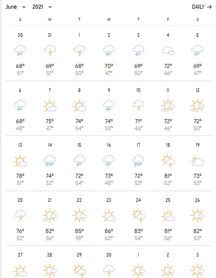
The weather changes…well like the weather…so you watch these estimates change daily/weekly. As I get closer and closer to the middle of June I tend to see the pattern settling down with the possibility of the prediction flexing a day or two up or down the calendar. I then pick my day and go.
I will then figure out the food plan. Always pack one extra meal than planned.
If I’m renting a GPS beacon, I factor in shipping time/day to coincide with departure plan.
Finally, I will print out a packet with my entire plan and emergency contact numbers (DEC/Rangers/Etc) to leave with my wife.

Leave a comment